Title:
Streamline Current Chart - Western Pacific Ocean (Nov.-March)
Object ID:
2017.049
Object Name:
Chart, Navigational
Scope & Content:
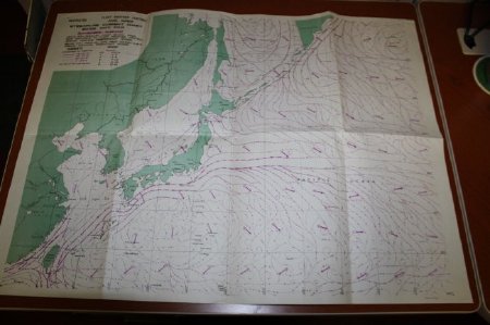
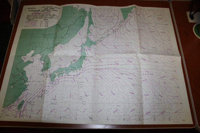
A World War II-era chart of the Western Pacific Ocean showing the streamline (predominant and resultant winds) currents for the period of November through March. The chart shows the region from the 115th to 175th longitudinal lines and from the 20 degree to (approx.) 60 degree lattitude lines. The chart is unmarked and was used aboard LST-1040 during service in region during World War II.
Click to Enlarge
 Full Chart
 Legend
 Full Chart
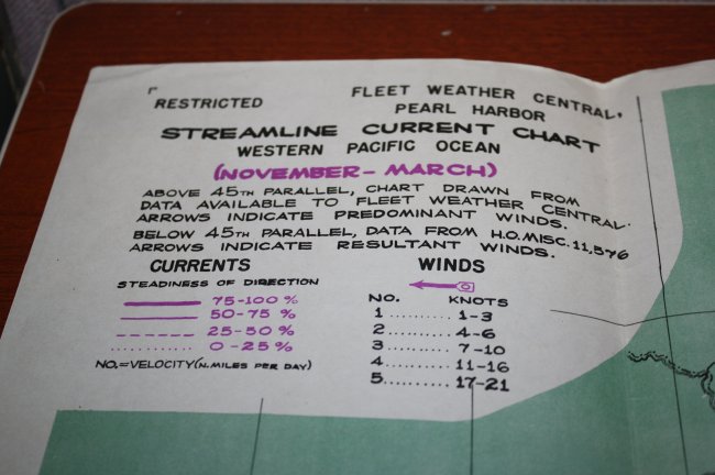 Legend